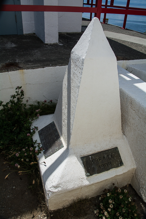
When visiting the Lighthouse a number of people ask about this “obelisk”, curious about its purpose. Here’s the story.
This is a “REFERENCE MARK” that indicates exactly where the border between Canada and the United States is located (in the middle of Juan de Fuca Strait). This marker is required at this point (on land), because (obviously) a marker cannot be placed on the water in the middle of the Strait.
The border is overseen by the International Boundary Commission (a joint Canadian/US agency). While the border had been established for some time, in 1908 the United Kingdom (at that time, acting for Canada) and the United States agreed, under Article IV of the Treaty of 1908, to re-survey the boundary, using “modern” surveying techniques. That work took quite a number of years, and resulted in a number of minor changes along the boundary. It also resulted in the installation of this Reference Marker at the lighthouse after it was established in 1912. (Note: it is not known exactly when the Reference Marker was installed – although it is indicated on the marker that it was in 1927 or later).
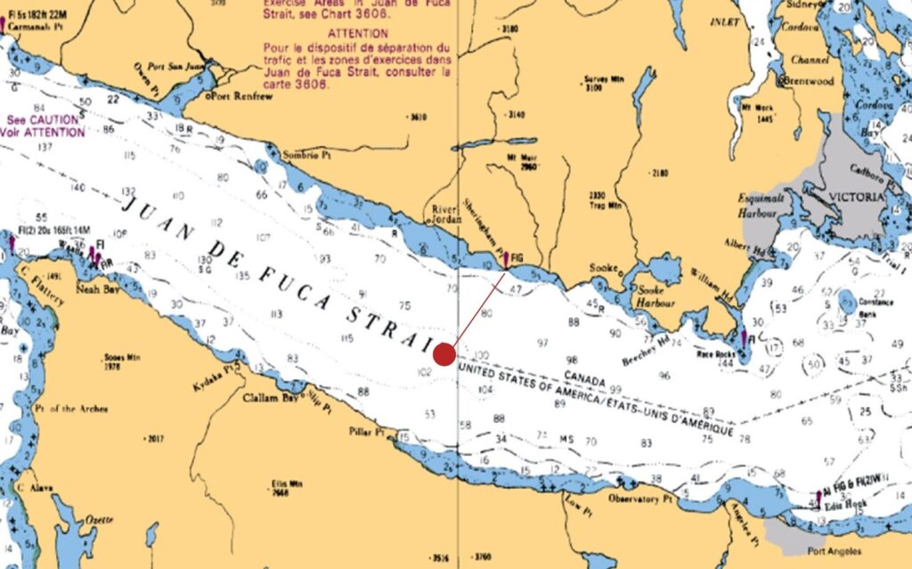
Where is the Boundary?
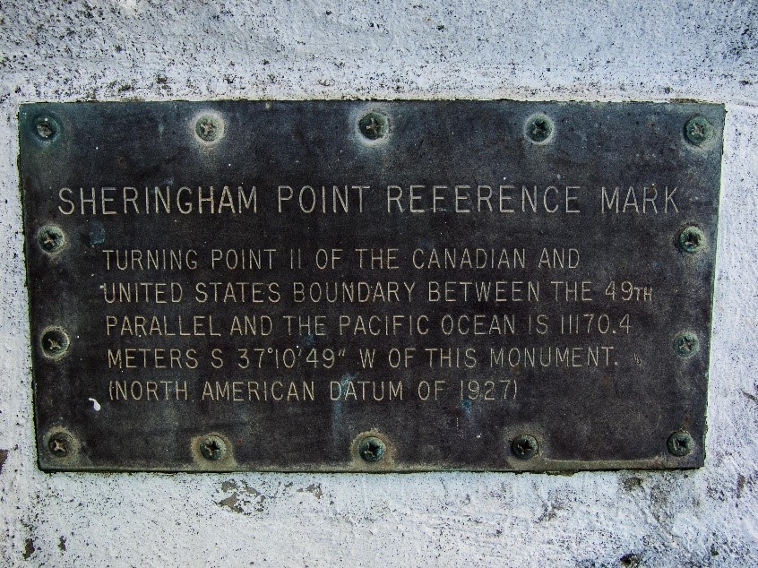
As the plaque indicates, at a distance of 11,170.4 metres, (i.e. a little more than 11 km) in a direction that is 37 degrees, 10 minutes and 49 seconds West of South from the monument (or, approximately South-West), is the point at which the boundary turns (see red dot on map below).
Comments are closed.
SITE OPEN HOURS
9:00 am - 7:00 pm
MESSAGES FOR VISITORS
LOST & FOUND
Conditions at the site are currently variable. Please be prepared for changing, windy and wet conditions.
DONATION / MEMBERSHIP PAYMENT
Please choose one of the options below to make your donation or membership payment now.